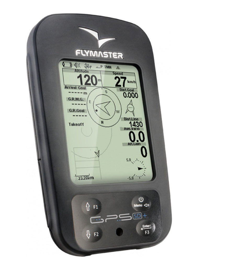
Flymaster GPS SD 3G
$650.00
Product Details
Flymaster Avionics presents the GPS SD 3G, a new intermediate instrument designed for Cross-Country flying.
The GPS SD 3G has all the XC flying features of the NAV and LIVE, except those specific of competition flying.
It is a totally new instrument engineered from the LIVE, from which it inherit the new architecture, including for example the new main board and the display with its new protection.
Flymaster includes 3D AIR-SPACES on the GPS, promoting significantly increased safety.
As the other products of the new range, the GPS allows pilots to design their own multiple screens, with the new FLYMASTER DESIGNER software.
With the user-friendly DESIGNER, every pilot can enjoy designing any screen he wants, each with the data he wants, placed where he wants, in the size he wants!
No more complains about small figures: everyone can set them the favorite size!
And cross-country pilots can set up all the tricks they want for each circumstance and personal preferences! Brilliant!
The structural design of the GPS casing makes it far more sturdy than the previous range of instruments and provides high strength protection of the screen against scratches and breaking.
The Flymaster GPS is “navigation made simple” for leisure and cross-country flights, ensuring the best value for money on the market, and adding a significant increase in safety with the 3D restricted airspaces features.
Engineered for Easy Navigation and Safety
The GPS SD+ is the ultimate Flymaster flight instrument that shares with LIVE SD all hardware including the GPRS Module, but limited to non RACE competition functions. It is specially built for pilots with XC Flying in his veins which want the extra safety of the LIVETRAKING .
Safe XC-flying
XC flying is rewarding, yet landing out alone can be scary the LiveTracking system you will never be alone on your XC adventure. Flymaster LiveTracking technology is the standard for theParagliding World Cup and the Red Bull X-Alps.
Don't get caught in airspace
With Flymasters 3D airspace warning system you will have ample information to navigate around restricted airspace zones.
Design your own instrument
Need more or less data on your flight screens, with Flymasters' unique Designer you can create the instrument you like and need for your style of flying. Learn more with this ---> video.
Thermal efficiently
Flymasters' unique thermal ball will help you find the thermal core quicker and the zero buzzer make sure don't fly past lift. Learn more about the thermal ball with this ---> video.
Flight Sharing
Flight Sharing can be extended beyond the LIVE-TRACKING. Just with a few key strokes, you can send your flights, just after landing, to several well know databases like Leonardo, or DHV.
Learn more about airspace avoidance The Flymaster 3D airspace avoidance system provides tools to manage airspaces. Restricted areas can be seen in an embedded Map, or on a dedicated page. The Map can be complemented with numerical, and text information using data fields. The Critical Airspaces dedicated page can be used to see detailed information about areas that are close to the pilot. In addition to graphic information, audible alarms and page triggers will ensure that even the most inattentive pilots does not miss critical information. For example, when flying near a restricted area an alarm is issued and the airspace page automatically enabled. Taking advantage of the SD card storage capacity the instrument provides worldwide airspace data (available soon). Pilots can fly from country to country without any concerns about changing airspace data files. Learn more about Live Tracking With the GPS SD+ you can be part of the well known FLYMASTER LIVE-TRACKING NAVIGATION SYSTEM (Patent Pending) proven in several competitions, like the Red Bull X-Alps, or PWCA. This innovative system enables real-time flight monitoring - live-tracking – over Google Earth, enhancing sharing of flights and contributing significantly to improve flight safety. Safety can even be augmented by configuring the GPS SD+ to periodically send an sms with information like position, altitude, or speed to a defined recipient.
![[Product_title] - Super Fly Paragliding](http://superflyinc.com/cdn/shop/products/Screen-Shot-2014-09-11-at-3.56.05-PM_grande.jpg?v=1523508216)
![[Product_title] - Super Fly Paragliding](http://superflyinc.com/cdn/shop/products/Screen-Shot-2014-09-11-at-3.02.43-PM_1_grande.jpg?v=1523508217)
![[Product_title] - Super Fly Paragliding](http://superflyinc.com/cdn/shop/products/Screen-Shot-2014-09-11-at-3.02.54-PM_f48b578d-5515-4e73-8b2e-55e993c03708_grande.jpg?v=1523508217)
![[Product_title] - Super Fly Paragliding](http://superflyinc.com/cdn/shop/products/Screen-Shot-2014-09-11-at-3.03.07-PM_ed8183c5-1f78-4b89-b1c1-c6904676ac31_grande.jpg?v=1523508218)
![[Product_title] - Super Fly Paragliding](http://superflyinc.com/cdn/shop/products/Screen-Shot-2014-09-11-at-3.03.16-PM_e3152709-f865-4abf-b075-21f7e800e751_grande.jpg?v=1523508218)
![[Product_title] - Super Fly Paragliding](http://superflyinc.com/cdn/shop/products/Screen-Shot-2014-09-11-at-3.03.33-PM_8bab9424-26d3-4aa8-b4e9-84fe5a1ee67c_grande.jpg?v=1523508219)


![[Product_title] - Super Fly Paragliding](http://superflyinc.com/cdn/shop/products/Screen-Shot-2014-09-11-at-3.56.05-PM_compact.jpg?v=1523508216)
![[Product_title] - Super Fly Paragliding](http://superflyinc.com/cdn/shop/products/Screen-Shot-2014-09-11-at-3.02.43-PM_1_compact.jpg?v=1523508217)
![[Product_title] - Super Fly Paragliding](http://superflyinc.com/cdn/shop/products/Screen-Shot-2014-09-11-at-3.02.54-PM_f48b578d-5515-4e73-8b2e-55e993c03708_compact.jpg?v=1523508217)
![[Product_title] - Super Fly Paragliding](http://superflyinc.com/cdn/shop/products/Screen-Shot-2014-09-11-at-3.03.07-PM_ed8183c5-1f78-4b89-b1c1-c6904676ac31_compact.jpg?v=1523508218)
![[Product_title] - Super Fly Paragliding](http://superflyinc.com/cdn/shop/products/Screen-Shot-2014-09-11-at-3.03.16-PM_e3152709-f865-4abf-b075-21f7e800e751_compact.jpg?v=1523508218)
![[Product_title] - Super Fly Paragliding](http://superflyinc.com/cdn/shop/products/Screen-Shot-2014-09-11-at-3.03.33-PM_8bab9424-26d3-4aa8-b4e9-84fe5a1ee67c_compact.jpg?v=1523508219)
Connect